
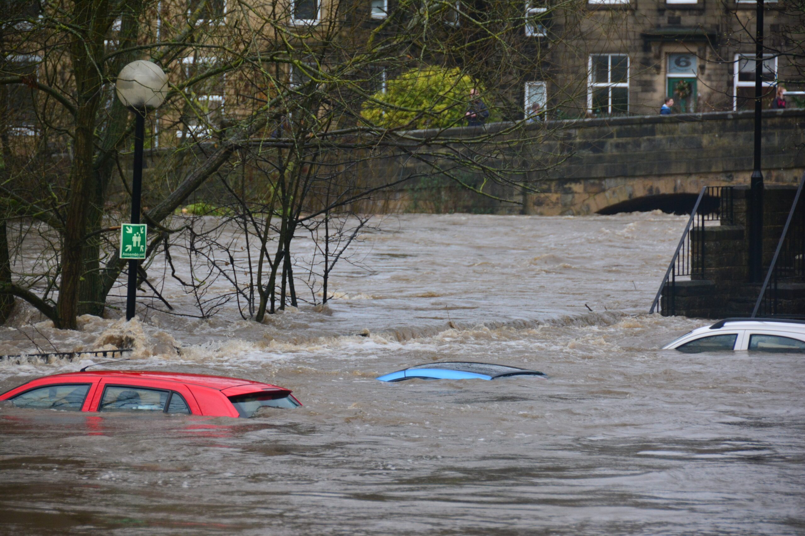
Flooding becomes more and more challenging for the emergency services. It would be a big help if storms and their impact could be predicted more accurately. By using the forecast tool, emergency services are enabled to use their means more efficiently. Damages from flooding can be avoided or at least be reduced. The model uses among other things real time radar images to analyze rain clouds, completed with real time data from pluviometers and water level sensors. The sewers are mapped and sensors in the sewers measure in real time how much water can easily flow away through the sewers.
In a first phase, the model was built for a test area for the Antwerp municipalities Ekeren/Merksem. The water nuisance and the flooding that these municipalities had to face in the past, made this area an ideal test area. Very heavy rain showers that distressed these municipalities in June 2019 were very well predicted thanks to Flood4Cast.
In this project, VITO and the engineering company Hydroscan were responsible for the hydrologic expertise, this included the set-up of the calculation instrument, data interpretation with the addition of a limited sensor measurement network (precipitation and water levels) and advice was given about the way the results can be visualized.
Further information here.
FLOOD4CAST helps emergency services to anticipate flooding
Kategorie: Products & Solutions
Autor: Jonas Völker
Das könnte Sie auch interessieren:

15
Jun
2023
Jun
2023
Full ‘at scale trial’ of technology to cut NO₂ emissions of a WWTP
Suez announces its partnership with Severn Trent Water in the multimillion Net Zero Hub set to start in September in the latter's Strongford Sewage Treatment Works in Staffordshire, ...

21
Apr
2023
Apr
2023
Increasing Biodiversity on the River Clyde at Glasgow Science Centre
Biomatrix Water has installed Biomatrix Floating Ecosystems at the Science Centre in Glasgow. Glasgow Science Centre is a cutting edge visitor attraction bringing the wonder of science to hundreds of thousands of ...

27
Mrz
2023
Mrz
2023
Novel Membranes for Better Wastewater Treatment
Together with population growth and industrialisation, water scarcity tops the list of global ...
Passende Firmen zum Thema:
Publikationen
Sie möchten die gwf Wasser + Abwasser testen
Bestellen Sie Ihr kostenloses Probeheft
Überzeugen Sie sich selbst: Gerne senden wir Ihnen die gwf Wasser + Abwasser kostenlos und unverbindlich zur Probe!
