
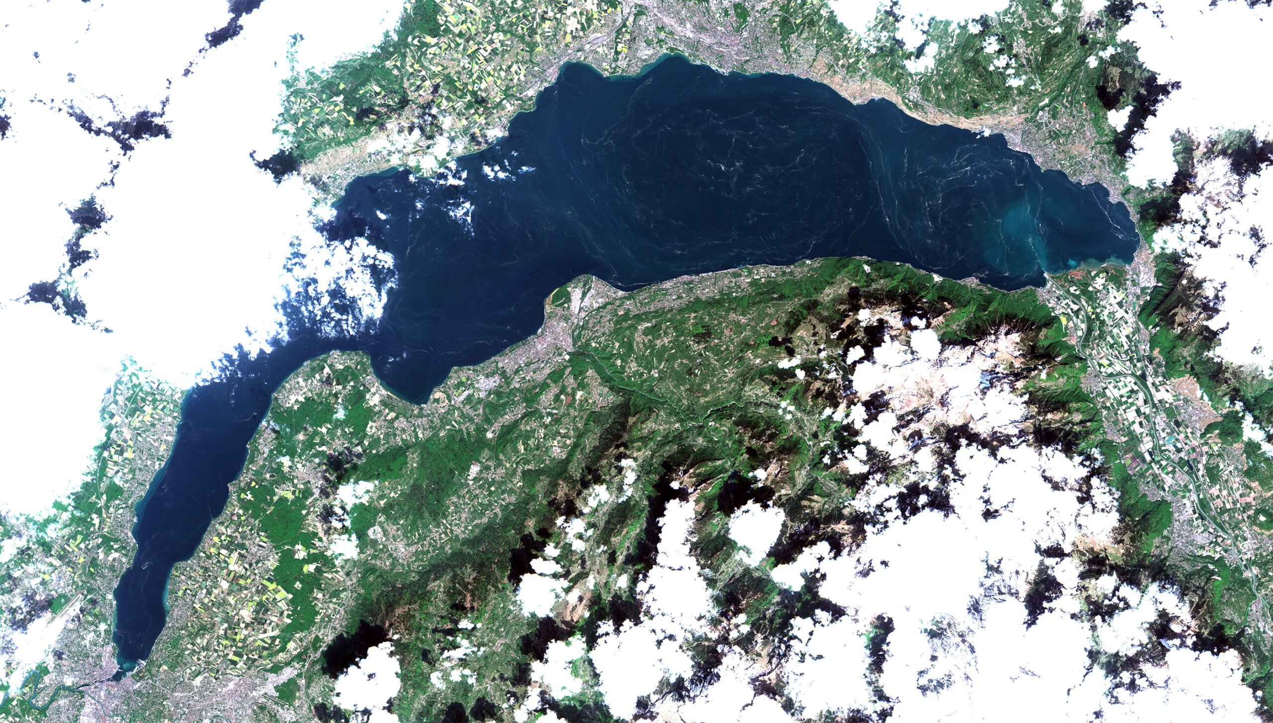
The image of Lake Geneva was captured by the Sentinel-2A satellite on Friday, 24 April, and shows deposits of pollen that match the currents on the lake surface. For remote sensing expert Daniel Odermatt of the Eawag aquatic research institute, the image is not only aesthetically pleasing but also extremely interesting because the currents that are suddenly visible can be compared with models. Indeed, the pattern shows very good agreement with the calculation issued for the same day on www.meteolakes.ch.
The large, central gyre off the shore of Lausanne rotates approximately once every two days. “We have many individual point measurements taken from boats or from the floating platform LéXPLORE,” says Odermatt, “but the patterns in the satellite photos help us gain a better understanding of the lake’s behaviour across its entire surface.”
Since February 2019, LéXPLORE platform is anchored on Lake Léman near Pully. This platform is equipped with state-of-the-art instrumentation, to obtain simultaneous observations of physical, chemical and biological processes at high temporal and spatial resolutions. This unique dataset will allow modelling the key processes in the lake, in order to predict the lake evolution and the impacts of environmental changes. More information about the floating platform laboratory can be found here.
Pollen vizualizes huge gyre in Lake Geneva
Kategorie: Sonstiges
Autor: Jonas Völker
Das könnte Sie auch interessieren:

Mrz
2024
Trügerische Idylle: Stettiner Haff ist Bedrohter See des Jahres 2024
Das Stettiner Haff erstreckt sich über beide Seiten der deutsch-polnischen Grenze. Mit seiner Größe von 70.000 ha und als Teil des Oderdeltas spielt es eine Schlüsselrolle bei der Erhaltung der Artenvielfalt in der ...

Mrz
2024
Rasante Raubfische wechseln Farben auf der Jagd
Eine Studie des Exzellenzclusters "Science of Intelligence" (SCIoI) mit der Humboldt-Universität zu Berlin und dem IGB erforscht, wie die gestreiften Marline die schnelle Abfolge ihrer Angriffe koordinieren können, ...

Feb
2024
Unterirdischer Wassertempel schützt vor Hochwasser
20. Februar 2024 ǀ In Japan findet sich das weltgrößte unterirdische Entwässerungs- und Kanalisationssystem, genannt Shutoken Gaikaku Hōsuiro (首都圏外郭放水路, dt. etwa äußerer Entwässerungskanal für ...
Passende Firmen zum Thema:
Publikationen
Sie möchten die gwf Wasser + Abwasser testen
Bestellen Sie Ihr kostenloses Probeheft
Überzeugen Sie sich selbst: Gerne senden wir Ihnen die gwf Wasser + Abwasser kostenlos und unverbindlich zur Probe!
